King Island to Launceston
28/3/16 – 31/3/16
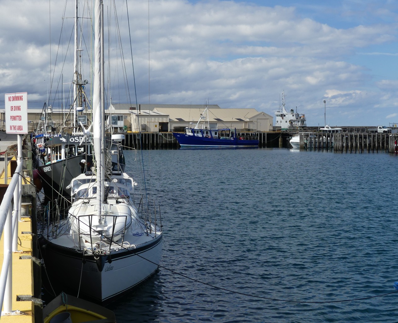
Sliding out of Grassy Harbour presented few
of the hurdles that we had faced on the way in. There were no rain squalls to
impair our visibility, and although cloudy, the wind had softened and we had
soon retraced our steps to the open sea. A warming coffee and two of Cookie’s
peerless cheese and tomato jaffles, hot from the galley, had fortified us
before we slipped from the security of Bear’s mooring.
 |
| Passing Frog Rock on our way out of Grassy Harbour |
As King Island receded in our wake, our early
hopes of a lively sail across the 47nm passage to Three Hummock Island were
foiled by the light airs close to the coast, before in waters open to the pulse
of the Southern Ocean we sensed the winds lift along with the swell. We were
galvanised into activity as now it was time to unfurl our equipment and show
how Calista could carve through the
billows. If you could book an optimum sailing breeze, like the fabled porridge,
not too much of one, too little of another, then this was it. Too good was this
to be left in the hands of mechanical devices: it was a case of the crew
scrambling for a “turn” at the wheel, with cool wind in our hair, and bumps
rising on the horizon that became Hummocks as the day progressed. We had waited
for a passage like this.
 |
| On approach to Three Hummocks |
Our early plan was to make for the spacious
and sandy anchorage of East Telegraph Bay, but Mary’s forecast update had a
light southerly setting in overnight, so we settled on the Mermaid Bay
anchorage on the northern coast of Three Hummock Island. As we drew near there
were unmistakeable similarities between the coastline of Three Hummocks and
that of the Jessieu Peninsula, stretching from Cape Donnington to Memory Cove
out from Port Lincoln. Our ground tackle rattled out into excellent holding in
the bay, and with shadows lengthening, we opted to enjoy the delights of this
place from our cockpit vantage point, rather than marshal a hasty trip ashore.
As the day became evening we had hoped for the beam of the Cape Rochon Light on
the nearby headland to illume the gloom, but its beam is directional and we
could detect no trace of it from the snugness of our anchorage. Into the
evening and throughout the night Fairy Penguins pierced the air with their
discordant carolling, and we wondered when they ever slept. Here there are many
Fairy Penguins and few seals. At home there are now many seals and now few
penguins. The lament about our disappearing penguin populations at home is
explained by what we have observed here. We have joined the dots.
 |
| Securely anchored in Mermaid Bay |

Again the redoubtable Mary’s weather report
confirmed most of what we feared was about to unfold, along the North-West
Coast of Tassie. The infamous Cape Grim where the wind always howls lay only
miles away and approaching weather from the Southern Ocean would mean that for
seafarers new to the area, it would be prudent to make for a secure mainland
port before conditions collapsed. The good thing though, was that if we were
nimble, we could fit in a whistle-stop visit to the historic port of old Stanley
town before making for the security of the Beauty Point Marina on Launceston’s
Tamar River ahead of the change to come. All of this meant that a land exploration of
Three Hummocks would have to be shelved, if we were to make it to Stanley in
time to sup on its renowned delights. This meant, too, an early get-up and a
hasty gulp of cereals instead of the preferred jaffles, before putting to sea.
 |
Leaving Mermaid Bay
|
With Cape Rochon rounded, we set to sea into
a wind that was niggardly of direction and a sea state confused by an ebbing
tide. The currents around Hunter and Three Hummock Islands are well known for
their contrary nature, and it seemed to us that on this morning the currents
were every bit contrary as though they were issuing a cautionary message to
visitors like us. What was clear however was that we would not need to deploy
our arsenal of electronic equipment to find the port of Stanley on the map. The
town huddles in the shadow of a long extinct volcanic plug, called “The Nut”,
which is clearly visible for miles and miles away. There, to be sure was The
Nut, like an inverted bowler hat, prominent and unmistakeable, off our bow,
even though it was over 30 miles away. What we needed to do was to proceed with
as much haste as we could muster so that we could tether in the harbour and see
if a scaling of The Nut, plus a lap of the town could be achieved in daylight
hours.
 |
| On approach to the Nut and Stanley |
 |
| The Nut |

Entering Stanley harbour & safely secured to the wharf
|
 |
With the day in decline and Calista secure, we set about a Stanley
reconnoitre, including an attempt on The Nut, minus crampons, ropes, and
oxygen. After what had been, we will admit, a hurried passage and a convoluted
arrivals process, we were off into town. Immediately we dropped back through
some gears, captured by the unhurried pace of this historic and homely outpost.

There is more than a pinch of the frontier about Stanley, being as approximate as it is to Tasmania’s wild, Wild West. Care has been taken to preserve the character of the town and the streetscapes are a delight to behold. Stay away from Stanley if the modern world of pre-fab and glass stirs your curry. Come and enjoy if you like the feel of old-world charm, hounds asleep on doorsteps, the wisp of log fires and buildings chiselled from stone by hardened men from another time. We were drawn to the Stanley Hotel with its unique bottle shop in an ancient cellar, and the potential of a night out on the town, well a pub feed at least, in the well regarded Bistro.
 |
| Charming historic Stanley |

There is more than a pinch of the frontier about Stanley, being as approximate as it is to Tasmania’s wild, Wild West. Care has been taken to preserve the character of the town and the streetscapes are a delight to behold. Stay away from Stanley if the modern world of pre-fab and glass stirs your curry. Come and enjoy if you like the feel of old-world charm, hounds asleep on doorsteps, the wisp of log fires and buildings chiselled from stone by hardened men from another time. We were drawn to the Stanley Hotel with its unique bottle shop in an ancient cellar, and the potential of a night out on the town, well a pub feed at least, in the well regarded Bistro.
 |
| No wonder there is a chairlift! |
First, though, The Nut. Having scaled some
uplands in our time, peaks in the Flinders Ranges, Volcanoes in Indonesia, and
the like, we presumed that The Nut would
be a doddle, and yet a doddle it was not. The Nut has a path that is steeply
up, and up some more, not that we thought for a minute of opting for the
chairlift to the top.

The walking trail around the top offered spectacular views to all points of the compass, giving us an eagle’s view of the vista away to the western wilderness, back to the isles from which we had come, over the harbour where our ship lay tethered, and away beyond the headlands where in the new day we would head. From atop The Nut it was evident just how tenuous was Stanley’s connection to mainland Tasmania, with only a narrow isthmus which provided links to the outside. From space, Stanley, and its Nut must appear as a dewdrop, stretched to breaking before falling to ground (a farmer might see a likeness to a bovine appendage, dangling from the coast!).

The walking trail around the top offered spectacular views to all points of the compass, giving us an eagle’s view of the vista away to the western wilderness, back to the isles from which we had come, over the harbour where our ship lay tethered, and away beyond the headlands where in the new day we would head. From atop The Nut it was evident just how tenuous was Stanley’s connection to mainland Tasmania, with only a narrow isthmus which provided links to the outside. From space, Stanley, and its Nut must appear as a dewdrop, stretched to breaking before falling to ground (a farmer might see a likeness to a bovine appendage, dangling from the coast!).

With our appetite honed by our afternoon
clamber, we were as equally pleased by our dine-out at the Stanley pub as we
had been with all other aspects of the town. The bistro menu extolled the
virtues of Cape Grim beef – the place must have some redeeming virtue – and
herself read no further than the promise of fresh fillets of local flake. Delish!
With the sun having set, we enjoyed a sated stroll back to the harbour, musing
that this must be some place when winter winds shriek in from the west and
Stanleyites huddle over wood fires seeking shelter from the storms. Sales of
local ciders probably go up as the temperature plunges. We think that we will
be better off far to the north when all this transpires. We would be nervous
about seeking shelter in Stanley in a tempest.
We have four fine cruising guides on board,
providing a host of information about voyaging in Bass Strait waters and along
the coastline of Tasmania. The latest of these publications, Cruising Victoria, an excellent
publication by the Cruising Yacht Association of Victoria, suggested that
between Stanley and Launceston, a distance of over 80 nautical miles, the
number of “must visit” anchorages might be few in number. We adopted an
approach of setting as close to the coast as we dare out of Stanley, to see for
ourselves what the top portion of the Tasmanian triangle had to offer.
 |
| Dawn light under sail along the north coast |
All this, plus a need to find overnight
shelter as close to the Tamar River entrance as we could, meant yet another
muster of the crew at dawn. We assumed that the northern coast of Tassie might
present little to stir the soul but we were pleasantly surprised at what we
found. Not far from Stanley, with the The Nut deflating, in our wake, Rocky
Cape and then Table Cape appeared as eye-catching and challenging places where
bushwalking was in the ascendant, as sweeping areas of natural forest clung to
granitic headlands.
Both of these features have noble lighthouses, real ones and not the industrial structures of modern times. Abeam of the Table Cape lighthouse, our ship’s glasses showed something unusual - tourists, out on the parapet of the light, peering out to sea! Via Google we discovered that the Table Cape light, is Australia’s only working lighthouse that allows visitors to take a trip to the top of the tower. Tours run every 20 minutes, and if our visual evidence was to go by, it had become a very popular activity for visitors to the area. Being lighthouse tragics, of sorts, we were more than a little envious of those aloft in the tower. As we made our way past, we wondered if they were wondering what our view of them was like from our craft out at sea, because we were wondering what their view was like, of us, from atop the lighthouse. We sailed on, wondering.
 |
| Rugged coastline of Rocky Cape |
Both of these features have noble lighthouses, real ones and not the industrial structures of modern times. Abeam of the Table Cape lighthouse, our ship’s glasses showed something unusual - tourists, out on the parapet of the light, peering out to sea! Via Google we discovered that the Table Cape light, is Australia’s only working lighthouse that allows visitors to take a trip to the top of the tower. Tours run every 20 minutes, and if our visual evidence was to go by, it had become a very popular activity for visitors to the area. Being lighthouse tragics, of sorts, we were more than a little envious of those aloft in the tower. As we made our way past, we wondered if they were wondering what our view of them was like from our craft out at sea, because we were wondering what their view was like, of us, from atop the lighthouse. We sailed on, wondering.
 |
| Table Cape |
Beyond Table Cape, smaller and larger towns dotted
the coast, as Wynyard, Somerset, Burnie, Penguin, Ulverstone and then the City
of Devonport slid by off our starboard quarter. We would have liked to have
detoured in to the Mersey at Devonport, not to see the ferry across the Mersey,
but more to see the ferry across Bass Strait that makes a daily passage to here
from Melbourne. Being small ship voyagers we wondered – again – what this trip
might be like in a Bass Strait gale. Then again, we might be better off just
wondering,
Our focus though, was more on finding a
secure overnight anchorage. In Stanley Cookie’s sleuthing from the cruising
guides had isolated a point in the lee of Point Sorell just past Devonport that
should provide a sheltered stopover before the short distance in the new day to
the entrance of the Tamar. The latest Central North Coast forecast confirmed
the sense of this plan, with a morning calm to be followed by a rising north westerly
in the afternoon ahead of a change. This coast is not a good coast to find
one’s self exposed to a rising ‘nor wester, and we would be well advised to be
in a secure place before this hit.
Finding a new anchorage in an unfamiliar
coastline can sometimes be problematical, especially late in the day with no
real “plan B” in place. Our anchorage was to be found in one of a series of
coastal indentations under the headland of Cape Sorell at a place called Edie’s
Point. To help us find the correct embayment, Cookie had located our anchorage
on Google Earth and now had a screen shot on our iPad, to make sure we could be
safely in before the sun had set. The last thing one needs on board is the
anxiety borne naturally from uncertainty marring a seaward approach. It was
good to be laying snug on anchor, knowing that we should be comfortable and
safe through the night, but first, we were looking forward to the consumption
of some fine fillets of flake, that had found their way aboard via the good
fishmongers of Stanley.
 |
| Pt Sorell anchorage in the second bay past the island on north east corner |
Having “done the distance” on the previous
day to Point Sorell there remained only a three hour passage in the morning to
the Tamar, via Badger and West Heads. The Tamar River is a substantial
waterway, which can be plied for many miles to Launceston, and consequently,
when the tide ebbs, a considerable volume of water flows down the channel and
muscles its way out to sea. We had heard of treacherous conditions to be found
off Low head at the mouth of the Tamar, especially if an outflowing river met
opposing wind and swell. Being mindful of this we intended to approach the
Tamar as close as we could to slack water – between the tides – although we
could not afford to dally too long with the wind about to rise.
With the above in mind we made for the Tamar
via Hebe Reef that guards the western entrance; the name Hebe being derived from the wreck of the Hebe on this reef in the days of steam and sail. Casting her eye on
the swirling waters of the reef, the helm was of the view that Hebe Jeebie reef would be better
terminology. No wonder that one of those industrial lights now steers vessels
away from the horrid rocks of Hebe Jeebie reef.
 |
| Swirling fog beyond the Hebe Jeebie |
Looking ahead to the Tamar though, there was
more than just a reef to induce the Hebe jeebies. There it was, seeping,
ghosting and slithering out of the valley of the Tamar.
Fog. Apparently fog is a problem on the Tamar from this time of year, and on
through winter. Happily it was not the Robe pea-souper of earlier in our
voyage, because we could not have headed on into it, although now, there was
probably enough visibility to see the lead beacons, marking the entrance to the
river. Ahead, though, we could see enough to tell that, unfortunately, the
outflowing tide was far away from being exhausted.
 |
| Plenty of tidal flow at the entrance |
When tidal rivers flow out to sea, tides at
their mouths are impacted by what the experts call overfall. An outrunning
tide, depending on its volume of outflow, does not stop with the change of tide
out to sea. It is like a runaway train that takes a time to grind to a halt.
Because of the Tamar’s volume, we found the river to be still running seaward,
well into the incoming tide. Although
large ships enter the stream, bound, for example for Bell Bay, our eight tonne
vessel was gripped and thrown by the swirl of the outflow as we made our way
upstream. Eventually, though, we were through the worst of it, and by following
the beacons and leads we found our way upstream to the Beauty Point Marina, an
offshoot of Launceston’s Tamar Yacht Club. Here, alongside the Australian
Maritime College, we looked forward to a secure tie-up and making some new
discoveries. True to his word, Lionel, the ever friendly and helpful retiree
who manages the facility was there to take our lines. It was great to be in
because, out across the Tamar, the nor-wester was on the rise.
 |
Beauty Point Marina approach
 |
Beautifully written Colin - I always find myself impatient for the next installment!
ReplyDelete